

Mobile Mapping
Street Check-Up

Satellite Navigation

Consultancy

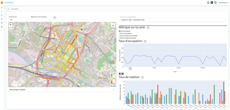
Analysis of parking spaces in Charleroi
Project : Web platform for analysing parking space occupancy in the City of Charleroi by using data collected by scan cars Client : Autonomous Municipal Authority
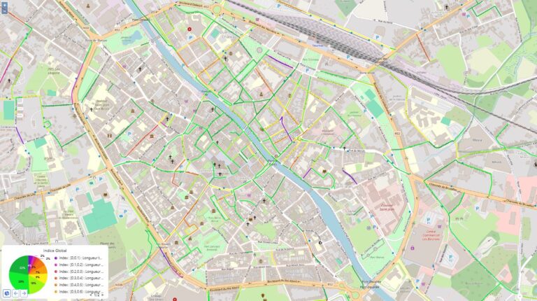
Pavement inspection by AI for the city of Tournai
Project : semi-automatic visual pavement inspection of the streets of Tournai city Client : City of Tournai, Technical Service Period : Avril – December 2023 Description :

DrivenBy 2023 press review
In June 2023, City of Kigali and AWEx presented on their X account the succesful project of Digital Infrastructure Mapping. On 15th June 2023, National