Project : Web platform for analysing parking space occupancy in the City of Charleroi by using data collected by scan cars
Client : Autonomous Municipal Authority of the City of Charleroi
Partner : Macq
Period : July 2024 – July 2025
Description :
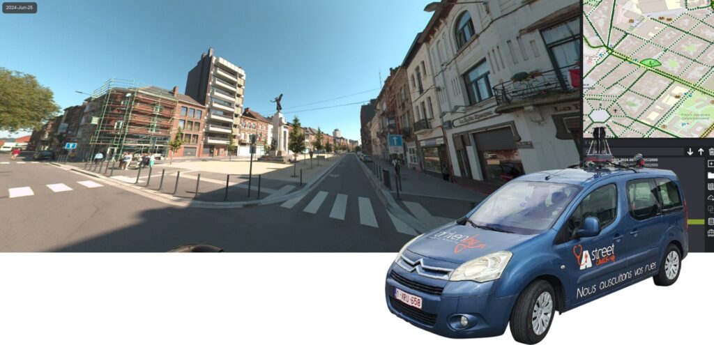
360° mobile mapping survey of regulated parking areas
Aerial survey and high-resolution orthophoto production
Accurate and up-to-date mapping of individual parking locations
Connection to parking-related information sources: subscriptions, scan cars, parking meters and mobile apps
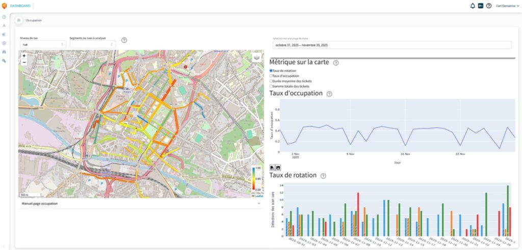
Development of a web platform with dashboards, dynamic mapping and statistical indicators: occupancy, user profiles, revenue, fees and scan-car operation.
Previous slide
Next slide
Deliverables :
GIS layer of street axes with parking information
GIS layer of individual parking spacest
Web platform with dashboards, dynamic mapping and statistical indicators: occupancy, user profiles, revenue, fees and scan-car operation